


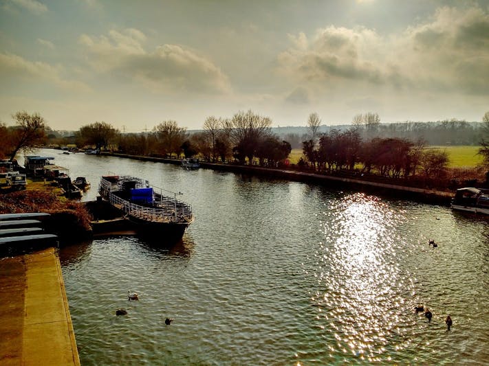
The Isis
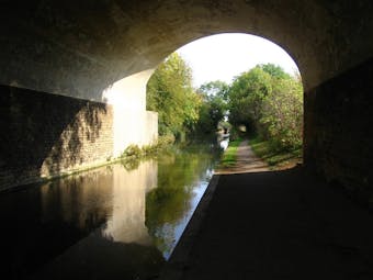
The most famous stretch of river in Oxford is undoubtedly the section between Folly Bridge and Iffley Lock. It's part of the River Thames, but popularly known as the Isis. It is here that the college rowing crews race against each other in the two annual regattas - 'Torpids' in late February and 'Eights' in mid May. Most of the College Boathouses are on the north bank which may be approached through Christ Church Meadow; the towpath, however, is on the south bank, and runs past a couple of boathouses, as well as the beautifully secluded Longbridges Nature Park. Iffley Lock is about 1.5 miles from Folly Bridge (which incidentally is the site of the original ford from which Oxford gets its name); some may be heartened to know that there is a pub at each end (the Head of the River at Folly Bridge, and the beautiful Isis Farmhouse at Iffley Lock).
Expect to see...
Rowers
And lots of them, all the time. Although the crews training for the Colleges go home occasionally, the city clubs still train several times a week. See our Rowing page for more information.Wildlife
Fairly uneventful, but varied. We've seen herons, Muntjac and Roe deer, as well as plenty of ducks and more interesting waterfowl.
Orientate yourself: click map
for Oxford districts overview
Click here to see all our Oxford Maps
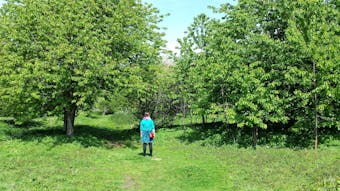
Port Meadow (SSSI)
The upper reaches of the Thames in Oxford wind through Port Meadow, a beautiful open pasture, accessible from Walton Well Road (off Kingston Road/Walton Street, Jericho), Aristotle Lane (off Kingston Road), Wolvercote and Binsey (via the Botley Road). Passing through the gate at the end of Walton Well Road is a well-defined white pebble path leading to the Thames (the concrete path heading off to your right goes to Wolvercote and the fantastic gem of Burgess Field Nature Park). The towpath runs north along the west bank of the Thames (reached by crossing first a flat wooden, then a steel arched bridge) and there are two pubs further along the way. The Perch at Binsey is the first of these; it serves excellent food and you can sit out in the pleasant garden in the summer. The Trout is about one mile further on, past Godstow Lock and the ruins of Godstow Nunnery, and next to the road bridge crossing the Thames. The Trout overlooks a very picturesque footbridge over the river, and peacocks and swans are often to be seen in the grounds. The easiest way back is the way you came, but the weary can follow the road over the river to Wolvercote, from where you can get a bus or taxi back to the city centre.
Those so minded can deviate from the side of the Thames long enough to visit Medley Manor Fruit Farm, where you can pick your own fruit, buy fresh asparagus and many more things each in their season. To find this delectable spot either follow signs to the Perch and then head through the car park and take the lane to the left (South) or head down the track just north of the sailing club which gets you to the same lane. Another detour from this part of Port Meadow is to Binsey Church. Again head west of the river towards Binsey village and this time take the lane north. Binsey Church is tucked away, small and sweet, with the original inspiration for The Treacle Well from Lewis Carroll's Alice in Wonderland in its churchyard. There are often very admirable pygmy goats next to the Church, which can be viewed over the churchyard wall. And finally, in late summer, anyone heading towards the Trout would be well advised to carry about their person a small vessel for collecting blackberries. (A stomach does well if there is nothing else to hand.) The best berries are on the sunny side of the thickety hedges. Head through one of the small gaps in the brambles, and round the other side you can pick enough for many pies.
Expect to see...
Rabbits, rabbits and more rabbits!
By late summer most of the baby rabbits will have emerged from the burrows, meaning hundreds of startled bunnies lining the paths.Other wildlife
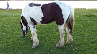
During winter, the meadow acts as a key site for migratory birds with the annual flood lake providing a roosting and feeding site. Although large flocks of Canada geese are frequent visitors, other, rarer birds often visit. During the Summer the river remains a fertile source of fish, attracting kingfishers and grass snakes. The red kites can normally be seen patrolling overhead, as they can over most of Oxford.
Flowers

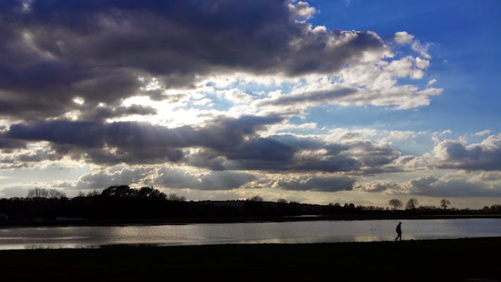
The Port Meadow sunset
In late autumn and winter the temperature inversion caused by the large pans of water often creates a dense, low-lying mist in the evening, allowing for ethereal and beautiful sunsets. In the summer enjoy a beer or some Pimms on the riverbank as the sun slowly sinks behind Wytham Hill.
The Cherwell and New Marston Meadows (SSSI)
There are a number of pleasant walks by the River Cherwell. 'Addison's Walk' is accessible from Magdalen College; another pleasantly shaded walk joins the University Parks with Marston Road via the amusingly named Parson's Pleasure (formerly nude bathing for Oxford fellows), Mesopotamia and King's Mill Lane (see the right hand edge of our Summertown map). Those who choose to walk north from the Parks should cross Rainbow Bridge and follow the path (which can get a little bit muddy in places) on the east bank. Lady Margaret Hall and the Cherwell Boathouse pass on the opposite bank before a footbridge is reached which gives access to Wolfson College and thence to the city. Alternatively, you may continue to walk north for a further half-mile when you will reach the Marston Ferry Road Bridge and, just beyond, the Victoria (Vicky) Arms, which serves food as well as drink.
Expect to see...
Wildflowers
The meadows are designated as a Site of Special Scientific Interest (SSSI), but are also maintained as a working farm. This means that by the river is Wolfson College Nature Reserve, featuring wildflower displays during May and June, but a wander through the fields might lead you to a fantastic hay meadow. Cut every year for hay, this meadow is a prime example of how hay cultivation historically led to fantastic arrays of wildflowers, and continues to today. Best time for viewing is June and July.
Wildlife
The wild deer that roam close to Oxford can also be seen along this stretch of river, including Muntjacs, Roe deer and Fallow deer. This writer swears he's seen a grass snake in the water, but it may well have been the wake of a punt.The vagaries of Oxford's waterways are such that you can also walk by the river to North or South Hinksey. You can cut through from Abingdon Road and there are bridges over the railway in several places. Pubwise, you have two choices: the General Eliott in South Hinksey or the Fishes in North Hinksey, which serves delicious food. If you can find a safe way across the dual carriageway of the Southern Bypass you could then head out onto Harcourt Hill, Cumnor Hill or even Boar's Hill for postprandial appreciation of the view which inspired Matthew Arnold's ubiquitous line about dreaming spires (though the views are sadly rather obscured these days).
Longer Walks
If you are feeling more intrepid and want more than a quiet ramble with food at the end, then you can simply continue on all these routes. The Cherwell footpaths will convey you in an afternoon to Islip, with one small but nevertheless unpleasant interruption - the Northern Bypass. The Thames is friendlier, not least because the Thames Path is now a national trail. From Oxford you can head out towards Abingdon, past Sandford Lock, and south. Radley village can be reached this way, though it's a couple of miles from the river. And if you wish you can continue to London and the Thames estuary. The river and the railway keep company for a fairly long stretch, so when you're footsore, by Pangbourne or so, you can let the train take over. There are lots of campsites along the trail, including camping at many locks. These can be extremely pleasant, and quite possibly extremely busy in high season. At Easter it's quieter, but colder. A very good map of the trail is available at Blackwell's (Broad St), designed for walkers and boaters. It has the phone numbers of the lock keepers and much other useful trivia.
The Thames Path continues in the other direction (broadly West) all the way to the river's source. If you wish to do it rapidly, carry little and stay at the various riverside inns. If carrying full kit, allow a good week for the 53.5 miles from central Oxford to the source at Thameshead. Most people seem to walk with the river flow. Between Lechlade and the sea there are boats, with narrowboats and cruisers sharing the non-tidal stretches. This also means locks, and they are a good source of fresh drinking water, as well as friendly lock-keepers, svelte dogs, amazing topiary and local knowledge. Between Lechlade and the source it is harder to replenish water supplies, and this should be taken into account. The Thames Path website suggests 14 days for the 184 miles source to sea, but that's strictly for the tough or masochistic. All in all if you're looking for a cheap, active and rewarding holiday The Thames Path is pretty good at most times of year. It's got good transport links at various points, so you can retrieve yourself, with Kemble station only a mile or so from the source. NB that at the times of year that are nicest for walking the source will be completely dry! The rest of the year beware of flooding, and due to the stiles not all the path is suitable for cycling.
Do allow yourself enough time at Cricklade to recover - there are a series of flooded quarries making up the Cotswold Water Parks, around 180 lakes in all. Available wildlife includes many birds, dragonflies, and yacht clubs. And after all that walking you'll surely deserve a fine dinner. Most highly recommended is the Red Lion, whose combination of local foods (including Kelmscott pork from pigs you'll have walked past) and international beers make for an extremely good meal. They also do b&b, and very fine bar food.
